- India
- International
Wednesday, Apr 24, 2024
Journalism of Courage
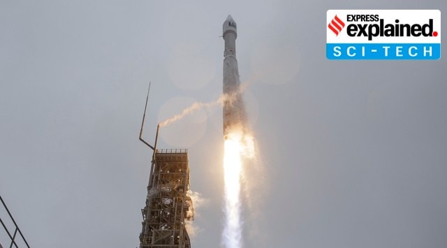 Liftoff of a Atlas V rocket with the Landsat 9 satellite onboard from Vandenberg Space Force Base in California. (Photo: Twitter/ NASA HQ Photo)
A NASA satellite was successfully launched on September 27 from Vandenberg Space Force Base in California. The earth monitoring satellite, Landsat 9, is a joint mission of NASA and the US Geological Survey (USGS).
The first Landsat satellite was launched in 1972 and since then, Landsat satellites have collected images of our planet and helped understand how land usage has changed over the decades.
In 2008, it was decided that all Landsat images will be free and publicly available and the policy has helped scores of researchers, farmers, policy analysts, glaciologists, and seismologists. Landsat images have been used to study the health of forests, coral reefs, monitor water quality and melting glaciers.
The Landsat 9 joins Landsat 8 that was launched in 2013 and the satellites together will collect images of Earth’s surface. It takes 8 days to capture the whole Earth.
Landsat 9 carries instruments similar to the other Landsat satellites, but it is the most technologically advanced satellite of its generation. It can see more colour shades with greater depths than the previous satellites, helping scientists capture more details about our ever-changing planet.

The instruments aboard Landsat 9 are the Operational Land Imager 2 (OLI-2) and the Thermal Infrared Sensor 2 (TIRS-2). They will measure different wavelengths of light reflected off the Earth’s surface.
 OLI-2 can see the light that we can’t see too. It captures sunlight reflected off Earth’s surface and studies the visible, near-infrared, and short wave infrared portions of the spectrum.
TIRS-2 has a four-element refractive telescope and photosensitive detectors that capture thermal radiation and help study the Earth’s surface temperature.
As the satellite orbits, these instruments will take pictures across 185 kilometers and each pixel will represent an area of about 30 meter X 30 meter.
Secretary of the Interior Deb Haaland, said in a release that Landsat 9 will provide data that can help make science-based decisions on key issues such as impacts of wildfire, coral reef degradation, the retreat of glaciers, and deforestation.
“Landsat 9 will be our new eyes in the sky when it comes to observing our changing planet,” said Thomas Zurbuchen, associate administrator for science at NASA in a release. “Working in tandem with the other Landsat satellites, as well as our European Space Agency partners who operate the Sentinel-2 satellites, we are getting a more comprehensive look at Earth than ever before. With these satellites working together in orbit, we’ll have observations of any given place on our planet every two days. This is incredibly important for tracking things like crop growth and helping decision-makers monitor the overall health of Earth and its natural resources,” Zurbuchen said.
If a forest is affected by drought, it will be seen in Landsat images and can help the researchers decode the areas at risk. Similarly during a wildfire, the Landsat images will capture the plumes of smoke and help study the extent of a burning. The satellite images can also help recovery experts plan sites for replanting.
Landsat images can also help identify water bodies affected by potentially harmful algal blooms. According to NASA, scientists are now developing computer programs that would use Landsat and other satellite data to automatically warn lake recreation managers when blooms pop up.
Landsat images have helped glaciologists study the melting ice sheets of the Antarctic and Arctic regions. The images can help track cracks in the glaciers, movement of glaciers, and decode how further global warming will impact them.
Landsat satellites make contact with a ground station every few hours and offload its data.
Mike O’Brien, ground station engineer of USGS told NASA in an interview last year: “Every time a Landsat 8 image comes in, I record on four independent different pieces of equipment. That way, if there’s a failure, I still have three other great copies.”
Karen St. Germain, director of the Earth Science Division at NASA Headquarters in Washington said in a release: “For nearly 50 years, Landsat satellites observed our home planet, providing an unparalleled record of how its surface has changed over timescales from days to decades. Through this partnership with USGS, we’ve been able to provide continuous and timely data for users ranging from farmers to resource managers and scientists. This data can help us understand, predict, and plan for the future in a changing climate.”
Newsletter | Click to get the day’s best explainers in your inbox

I met nobody in rural India who saw Modi asSubscriber Only

India’s trade with Israel & Iran, and impact of regionalSubscriber Only

As Lok Sabha polls begin, it’s over to the youngSubscriber Only

'Only Modi can shoulder task of PM for third term':Subscriber Only

'7% is not an adequate growth rate, India ought toSubscriber Only

The MPBSE Board will declare the Class 10 and 12 results on April 24, 2024. Students can check their results on the official websites or through the MPBSE mobile app. The exams were held in pen-paper mode in 7,500 centers across the state. In 2023, the toppers were awarded e-Scooty and laptops. Last year, the overall pass percentage was 55.28%.